
The latest in George Leopold’s guest series on the use of drone aircraft for Earth observations, science, and services…
NASA and NOAA are gearing up for the next series of hurricane-tracking flights that use Global Hawk drones as high-flying, long-duration sensor platforms. Two Global Hawks assigned to the Hurricane and Severe Storm Sentinel program and packed with radar along with other weather sensors are scheduled to fly missions over the Atlantic Ocean for just over a month beginning Aug. 20.
Among the array of new remote sensors is a compact Doppler radar capable of measuring the movement of wind and rain. The new system, called the High-altitude Imaging Wind and Radar Profiler (HIWRAP), also will serve as a test bed for a new method of gathering wind data, NASA says.
Some clever engineering was required to shrink the Doppler radar to 300 pounds, about the size of a small washing machine. The NASA Goddard engineers who designed a Doppler radar small enough to fly on Global Hawk benefitted from the constant shrinking of electronic components like radar transmitters. These advanced components also use less power.
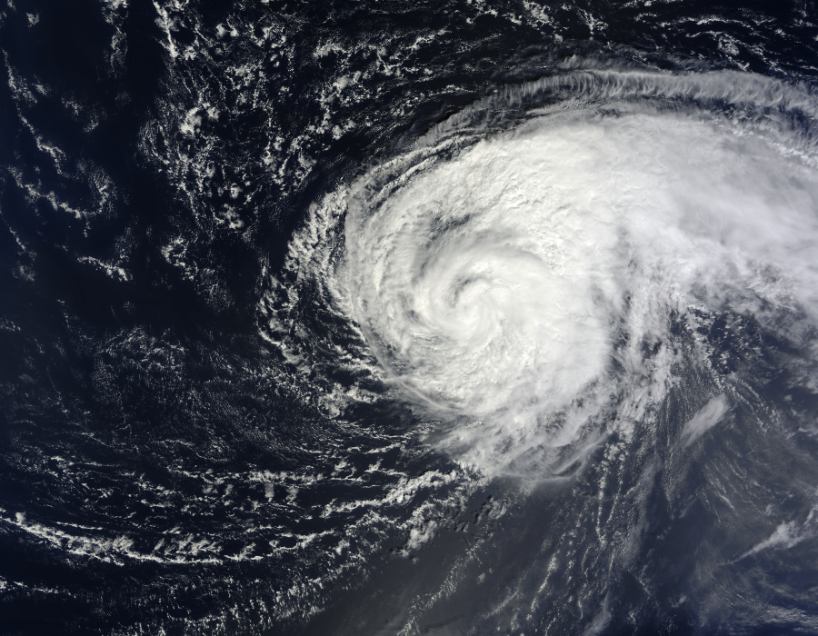 Improved remote sensors will be tested later this month to help unlock the secrets of Atlantic hurricanes.
Radars like HIWRAP generally require lots of juice to generate and rapidly transmit about 5,000 microwave pulses a second. The large number of pulses is needed to generate a three-dimensional profile of storm characteristics. NASA engineers combined low-power transmitters with an agile digital receiver capable of modifying outgoing microwave pulses. They also employed an electronically scanned antenna to widen the sensor’s field of view as Global Hawk flies over Atlantic storms at heights of 60,000 feet.
All these nifty innovations allowed NASA to pack an improved weather radar onto a drone, enabling it to gather not only wind data on hurricanes but also measure the Doppler effect of moving ice particles and raindrops. Those relatively new data sets could provide forecasters with a better picture of horizontal winds and circulation within hurricanes, researchers say.
They also note that only two U.S. weather satellites currently carry radar, and neither returns data on particle motion. Hence, the HIWRAP tests could help determine the configuration of the next generation of satellite radars that will track global precipitation several times a day.
With thousands of radar pulses bouncing around inside a storm, radar returns are often obscured by clutter when Doppler-shifted frequencies overlap. During the upcoming flights, Goddard researchers also will test a method for assigning identifiers for each outgoing microwave pulse.
Given budget constraints, political paralysis and lengthy congressional recesses that threaten to delay the launch of new U.S. weather satellites, NASA and NOAA are attempting to make greater use of available tools like high-flying drones as gap fillers. It turns out that these sensor platforms are also valuable test beds for wringing out the next generation of sensor technologies that can help improve hurricane forecasts.
-George Leopold